ARCTIC CIRCLE TRAIL REVISITED - SOUTHERN ROUTE EDITION

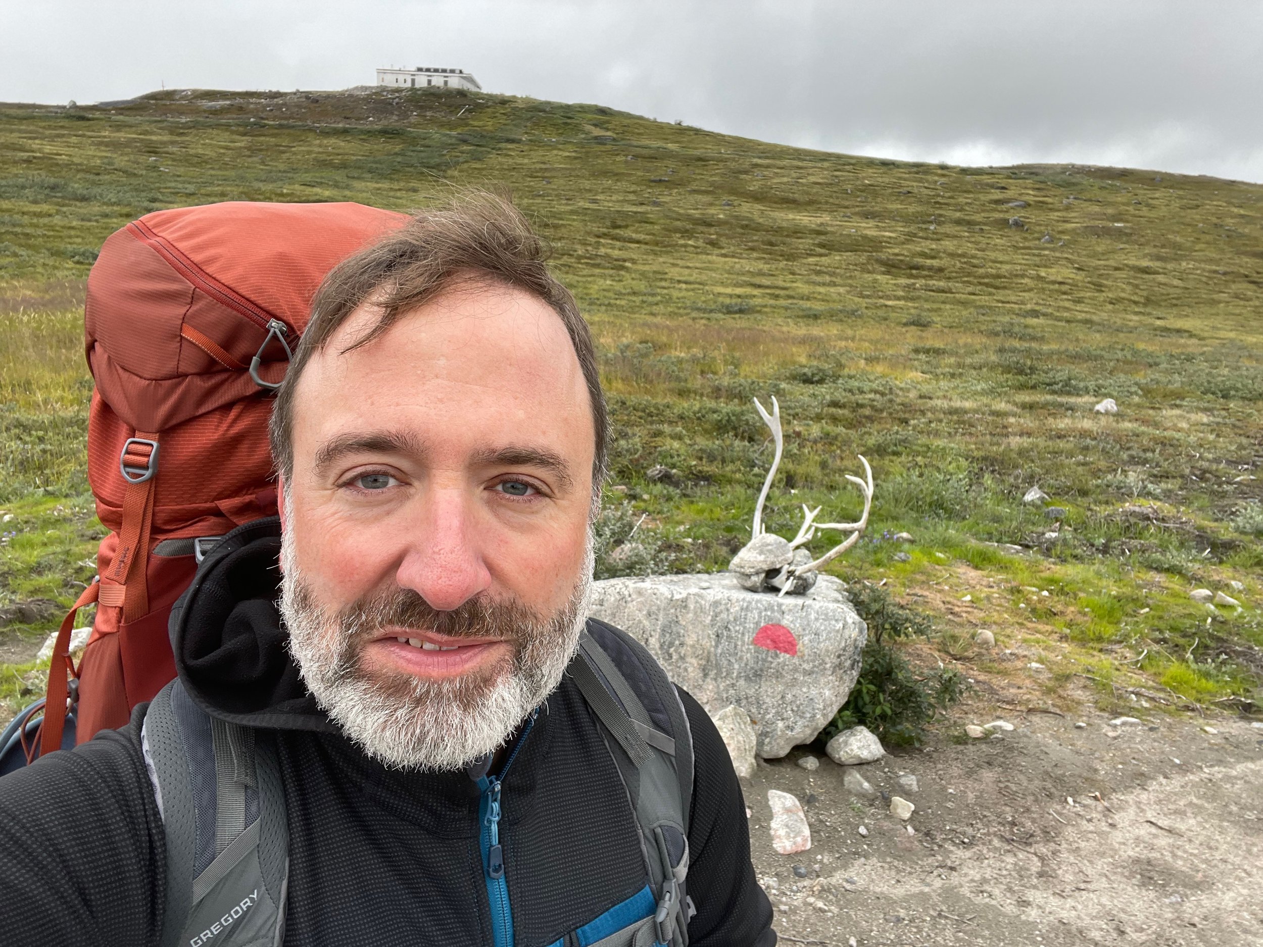
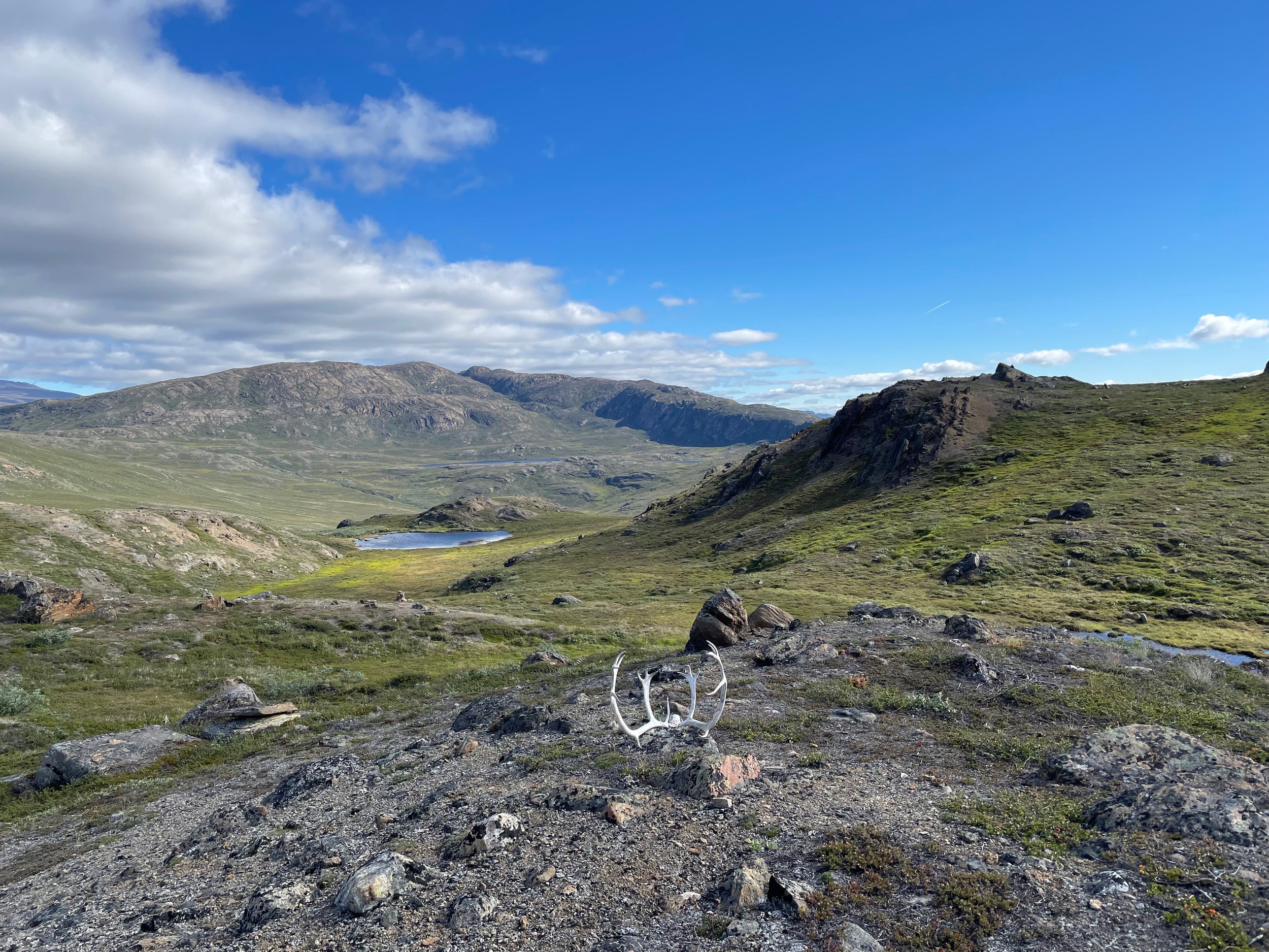
NEAR KANGERLUARSUK TULLEQ

The author on the Arctic Circle Trail - September 2014
It’s been almost 8 years since I first set of from Kangerlussuaq on the 100 mile (160 km) journey to the coast of West Greenland and the town of Sisimiut. As a professional guide I’m fortunate to live a life of adventure but this particular adventure has stayed with me as one of my favorites, the first time I truly felt like an explorer.
Following more of a general route than an actual trail at times, I didn’t see another human for 4 days and those I did meet were local Greenlandic hunters searching for reindeer. Alone in the Arctic for 7 out of 8 days I felt as connected to the wilderness as the reindeer and arctic hare I shared the terrain with. Not just a visitor passing through – I was where I belonged. (https://www.iagadventures.com/field-notes/alone-in-the-arctic-my-journey-on-the-arctic-circle-trail)
Over the years I’ve guided folks on the western half of the trail but haven’t been back to the eastern half since September 2014. Thanks to Visit Greenland and Destination Arctic Circle that would soon change.
7 AUG 2022: Day 1

Kangerlussuaq Airport (SFJ)
I woke up in the comfort of my room at Hotel Kangerlussuaq and packed up my things. I’d been on the road for most of the last two months guiding trips in Norway, Iceland, and Greenland so in addition to the gear I need for my current assignment – scouting the new Southern Route for Visit Greenland and Destination Arctic Circle – I’m also traveling with a suitcase full of clothing and a duffel bag full of gear. I’ve arranged to ship my extra bags via Air Greenland cargo but it’s a Sunday morning with limited staff on duty so I have to make sure to meet the morning shift leader between 9:15 -9:30 am since he and his crew will be tied up unloading the morning flight from Copenhagen due to arrive shortly after this time.
With my bags set for their own journey to the coast I head back to the hotel and grab my pack. In 2014 it was easy to just call a taxi for the ride to where the trail starts in Kellyville, a small research station that boasted an average population of 7 and a large antenna pointed skyward to study the Northern Lights. In 2014 I just asked at the terminal for a taxi and had one arrive just minutes later. As I checkout of the hotel I asked the clerk to call me a taxi and was surprised to learn they were no longer operating – sort of. I stopped in at the Albatros Arctic Circle tour desk and asked if I could pay for a ride with them. They do have this as an option but the trip doesn’t leave until 1pm (https://albatros-arctic-circle.com/sightseeing-kangerlussuaq). The trip will cost you 395 DKK (about $55).
My military background has taught me that when you come up against an obstacle you go around it, over it, under it, or through it, so I refused to give up and wait an extra 3 hours or add an unnecessary day of road walking to my wilderness adventure. I figured I would just find someone with a car and negotiate passage to Kellyville instead. Exiting the terminal I noticed what appeared to be 2 hikers waiting for a ride. They had contacted a local tour operator – Evald Thybo from Arctic Ice Tours (minik@1234.gl) – and arranged for the transfer. The transfer cost 500 DKK (about $70) per car and you could probably squeeze in 4 hikers and packs but I would confirm with the driver in advance. The 2 hikers – Vera and Ingo – from Germany, were gracious enough to let me tag along and since I didn’t have cash I offered to buy them a few beers in Sisimiut. A word of caution, it can be a fast and bumpy ride so buckle up!


CLICK IMAGE TO ENLARGE

Hundeso, the trail’s unofficial hut
The old route left Kellyville and followed a lake into the wilderness but the new route has you following the ATV trail for a while until you get closer to Hundeso where you pick up the footpath. Hundeso is really falling into disrepair and is expected be dismantled and removed in the near future so I wouldn’t plan on staying here unless you are desperate. In the past the only people that choose to stay here are those adding on the road walk from the airport terminal to the trailhead and if you decide to add this on to your adventure I would recommend tenting nearby instead.
DAY 1 FLYOVER
As soon as you pick up the trail you also pick up the bogs and mud. This season has been particularly rainy but I’ve noticed that the trail is also much more established now, beaten down and packed hard by the thousands of trekkers who have walked this path. When I hiked in 2014 there were an estimate 300 folks a year setting off on the trail but now it’s estimated there are a few thousand. I met more people in my first hour on the trail than I did during the entire 8 days back in 2014.
I used to joke that it was more of a route, more of an idea of a path than an actual trail but that has certainly changed in the years that followed. All of those boots have packed down what used to be soft surface into a hardened trail that allows rainwater to pool rather than pass through. Much easier to follow nowadays but also harder to keep your boots dry so I recommend packing 4 pairs of socks.


CLICK IMAGE TO ENLARGE

The trail you hope for and sometimes get
Still it felt great to be back out on the trail and in the Greenlandic wilderness. A rock ptarmigan was the first wildlife that greeted me as I walked, stopping to take photos or fly my drone along the way. It was great to not have a schedule, to not be in a rush, knowing that I’ll get to Kattifik (the first hut) when I get there and if I want to I can just set up my tent where I please. Freedom!
After passing a small beach the trail forks, with the more prominent trail leading you to the left. I took this one but would recommend folks go right instead. In 2014 I had a nice easy descent down to Kattifik, which I believe was from the path leading to the right. This time I wound up above the hut with a steep descent of mud and scree between me and level ground. One of the mantras I share with my clients is “There’s no shame in the butt slide!” It’s always better to slide down then fall and there were spots where I definitely followed my own advice.
I reached the hut roughly around what I would consider dinner time but folks inside were already in their sleeping bags getting ready for bed so after searching the register for my 2014 entry I set up my tent outside, using the hut to provide a sheltering lee from the considerable wind that night. New to this hut are a blue trash dumpster and the privy (outhouse). In 2014 I carried my trash for the full 8 days so I was very happy to see that Kattifik has received an upgrade.


CLICK IMAGE TO ENLARGE
KATTIFIK HUT
On my way to the hut I noticed that there were 2 canoes on the beach. I thought about getting up early so that I could enjoy the experience of paddling across the lake rather than walking along its shores but decided I’d rather sleep in a bit and enjoy my morning rather than be in a rush. Someone with the motivation to get an early start would enjoy that trip and for me, my adventure would take me back to the shoreline trail. I grabbed some water from the lake and enjoyed dinner al fresco, taking in the tranquil views of Lake Amitsorsuaq before preparing a hot water bottle to keep my feet warm and my sleeping bag extra cozy.
8 AUG 2022: Day 2
I was the last to arrive at Kattifik the night before and as usual the last one out as I sat around enjoying coffee and the view. When I finally started walking I was shocked to find a canoe still on the beach. I inspected it with some suspicion. The canoes l saw in 2014, the ones left over from the tourist operation at Canoe Center, were dented and twisted with duct tape patching holes to keep the water out. “What was wrong with this one?” I asked myself, not understanding why at least 6 earlier hikers had passed on the opportunity.
I also realized I was not exactly the last one out of camp. A couple heading east had camped behind a bluff just far away from the shelter as to be hidden from sight until you reached the beach. One of them, a woman, ran up and told me that they had paddled here from Canoe Center the night before and really loved the experience. I flipped over the canoe to continue my inspection but found only paddles and life vests. No damage. It seemed brand new and too good to be true this late in the morning but I took advantage of the opportunity, loading my pack near the forward seat to balance out the load.


CLICK IMAGE TO ENLARGE
STOPPING FOR LUNCH ON THE SOUTH SHORE
Getting a different perspective on an area you’ve already explored always makes the day more interesting. I traveled along the north coast for about a third of the trip and then switched over to the south. If you take a canoe you really owe it to other hikers to make sure the boat reaches either Canoe Center or Kattifik so please only stop and abandon your boat along the shore if the weather is dangerous or there is some other emergency. If you do stop along the way it is very important that you only bring your boat onshore where there is a soft sandy beach. Banging into rocks or dragging your canoe along them will shorten the lifespan of the boats and prevents a future hiker from enjoying this luxury.
The weather was beautiful that day and I felt truly blessed to have this opportunity. I started to get buzzed by some white birds along the north shore and realized I was getting a bit too close to their babies. I altered course to put them at ease and we departed on friendly terms. Later, as the weather took a turn, I stopped in at another beach to put on my rain gear and cover my pack before the final leg of the trip.

Solar power at Canoe Center charges as fast as an outlet
Arriving on the beach at Canoe Center in the rain I hurriedly gathered my gear and headed inside before returning to flip over my boat to ensure it would be dry for the next user. The last time I was here I had the whole place to myself, feeling a bit like Goldilocks as I wandered through the hut choosing among the 20+ beds to find the best spot. There were still plenty of options this time and I was happily sharing the hut with a truly international crew from Czech Republic, Germany, Poland, and Austria. I love meeting fellow travelers from around the world and this is definitely a benefit of the increased traffic on the trail. Another benefit is the recently installed solar panels that quickly charged up my phone and power bank. Just remember to pack an adapter if necessary.
9 AUG 2022: Day 3

Tortilla Pizza – “The breakfast of champions!”
Slept well and decided to continue doing so when I noticed it was raining outside. When I finally decided to leave the cozy confines of my down sleeping bag my lazy morning continued with a breakfast of coffee, granola with powdered milk, and a tortilla pizza (recipe in the Tips section below).
I drank coffee with Dani from Germany who was heading east towards Kattifik. We exchanged notes about what to expect and I passed on my experience with the canoe the day before. With the coffee gone we decided it was time to finally get going but she agreed to let me capture her departure with my drone so click below for a quick video of Dani leaving the Canoe Center.
DANI PADDLES AWAY FROM THE CANOE CENTER
Back on land for day 3 I quickly reconnected with the flooded trail before being greeted by several Ptarmigan hiding in the brush. After passing through the boulder field west of Canoe Center I reached a wide valley and remembered that I had seen several reindeer here back in 2014.
REINDEER ON THE MOVE
I hid out like a hunter and was quickly rewarded when a large buck came into view. I sent the drone out to capture this majestic sight but he was far into the valley and it was hard to locate him on the small screen of my iPhone. I could see him and I could see the drone but I just couldn’t get him on video. I brought the drone back to change batteries and when I turned around there was a female about 300 feet (100 meters) away from me. As I rushed to get the drone airborne again she took off but this time I was able to use landmarks to capture her on film, a brief portion of which you’ll find in the adjacent video.
.

Lunch on the beach
On the move again, I spotted some hunters skylined on the ridge above and wondered if they were after the same reindeer I filmed. The trail descends to a beautiful beach before climbing again so I decided to stop for lunch while also letting my feet dry out a bit.
The temperatures were beginning to drop when I reached the hut at Ikkattooq so I was glad there was room inside. I was arriving in much better condition than my last visit when I was teetering on the edge of hypothermia. Joining me in the hut that night were Jeanetta and Eva from Poland. As the wind outside was picking up we shared stories about past adventures from the comfort of our sleeping bags and drifted off to sleep happy to be inside tonight.

Ikkattooq Hut
A note on Ikkattooq: The blue trash bins at some of the huts are a new feature and not all of the huts have them. For years hikers simply carried their trash with them for 8 days or more so this is a luxury and not something you should expect at every hut. An open 50 gallon drum, such as you’ll find at Ikkattooq, is NOT a trash bin! Your trash will simply blow around once the wind picks up and cover the area with your garbage. PLEASE, do not leave trash in anything other than a properly covered receptacle and familiarize yourself with Leave No Trace (LNT) procedures and ethics. (https://lnt.org/why/7-principles/)
10 AUG 2022: Day 4
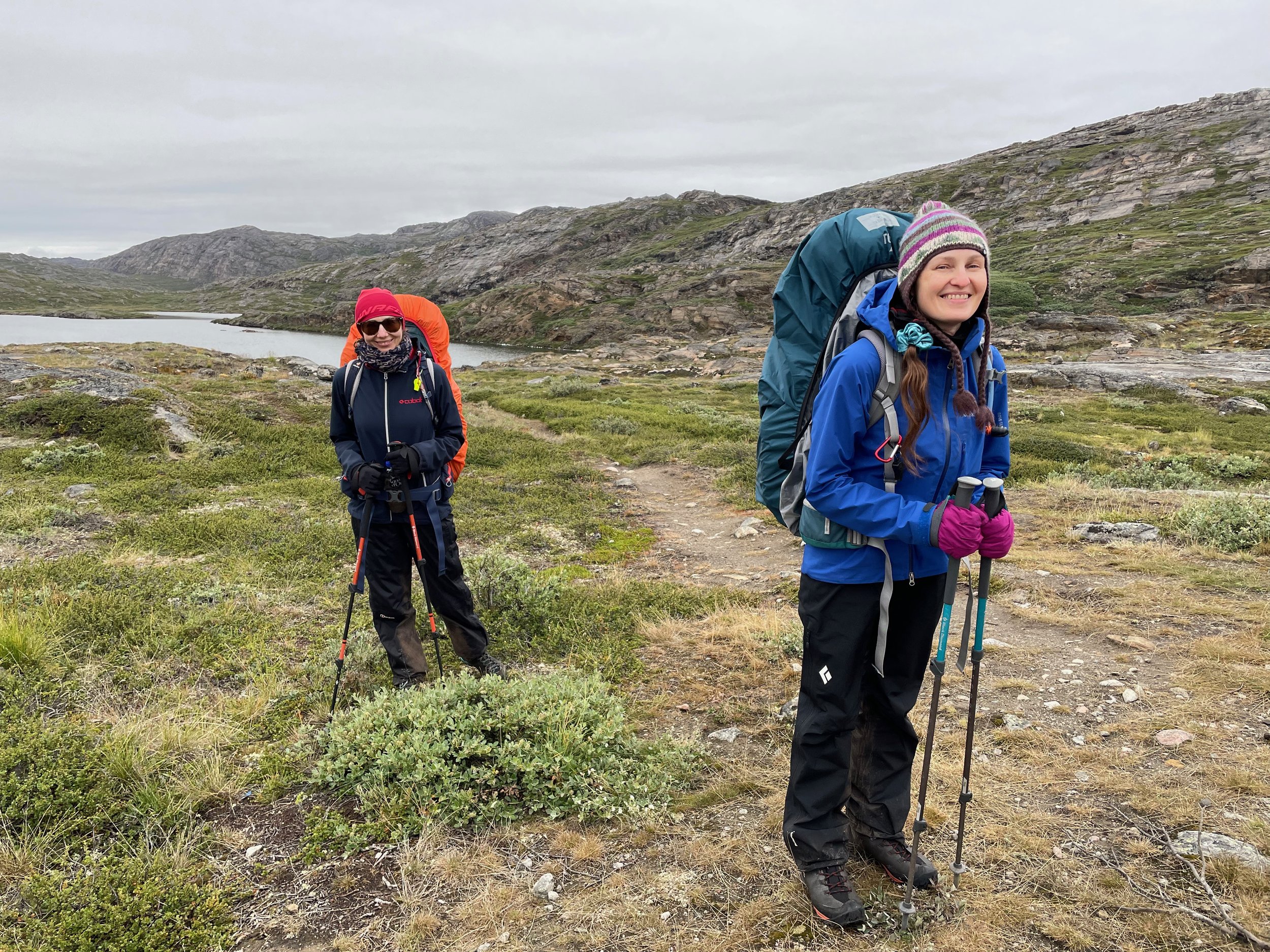
Eva (L) & Jeanetta (R)
Jeanetta and Eva were a little concerned about the day’s stream crossing and asked if they could join me for the day in case they needed help across. As we set out on the trail I remembered that the area between Ikkattooq and Ole's Lakseelv seemed to be teeming with Arctic Hare when I last visited and the local residents were just as active this time. Staring at us out of curiosity or cautiousness, their snow white fur marking their presence from a distance.
We descended down into the valley but the marked path took a very different route than I remembered. It was by no means direct and seemed to ignore the cairns altogether, adding distance to what should have been a short day. I believe this is due to the amount of folks following the GPS track and not the cairns, most likely following the winter route used by skiers and snowmobilers rather than summer hikers.
Eva & Jeanetta at Ole’s Lakseelv

Nikolai Olsen at center
As we reached the river I noted the depth to be around 2 feet (60 cm) in the center and scouted for the best location to cross. We were just about to take off our boots and pants to prepare for the crossing when a group of hunters drifted downriver and offered to shuttle us across. As we prepared to load our packs into the boat the group’s leader spoke from beneath his headnet and in English said, “I know you!” “I hiked back in 2014” I replied. “Kevin?” He asked. “Yes!” I said with astonishment. It was Nikolai Olsen, the fisherman from Sisimiut I wrote about in 2014 (https://www.iagadventures.com/field-notes/arctic-circle-trail-solo-hike-day-4).
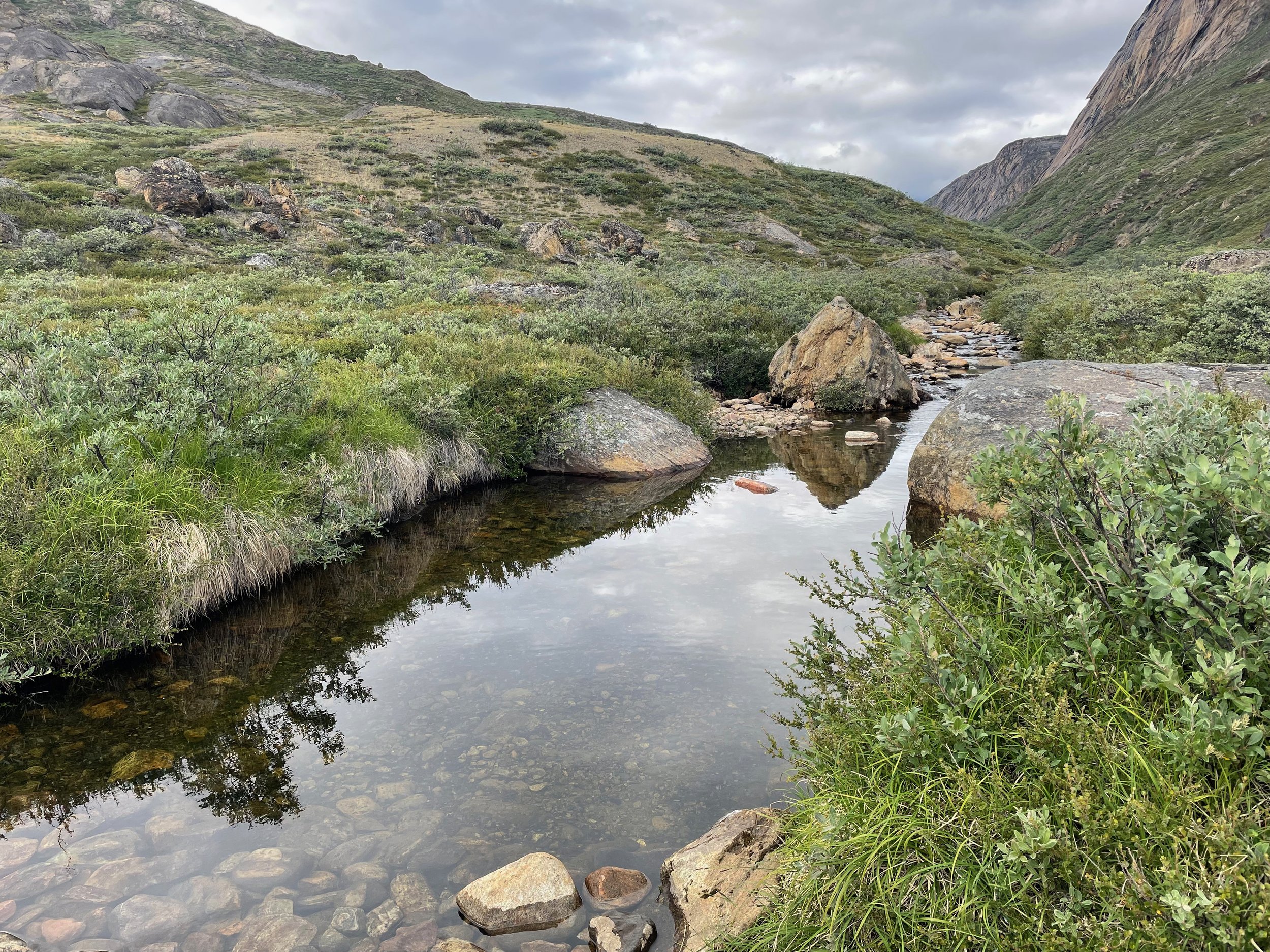
My outdoor bathtub
It was a high honor to be remembered 8 years later and though families in Greenland generally hunt the same territory each year the odds of meeting again at the same spot in the least densely populated country on the planet have to be pretty high. The fact that they would interrupt their hunt to help a bunch of foreign tourists cross a river just shows how friendly and welcoming the Greenlandic people are and I hope you get to experience their hospitality for yourself someday.
We reached the hut at Eqalugaarniarfik by late afternoon. I took advantage of a deep pool in the stream nearby to take a bath which felt amazing – Refreshed and halfway to Sisimiut! If you choose to do the same please make sure to use a biodegradable soap (such as Dr. Bronner’s) and use as little as you can. I’ll begin the Southern Route tomorrow and expect to be alone so I enjoyed having company for dinner. Off to bed early and excited about the new adventure.
11 AUG 2022: Day 5
On the Southern Route
The real adventure starts today and not knowing what to expect is part of the excitement.
Reindeer running away
I set out early and followed the cairns south from the hut. For a time the route followed the old road that was used to bring in heavy equipment for the nearby earthen dam but soon I was climbing uphill and off trail, bushwhacking my way from cairn to cairn. I spotted an Arctic Fox while on the road and the farther from the road I walked the more reindeer appeared. Some of the younger bucks seemed either confused, curious, or maybe even threatened by my presence, moving slowly towards me at first before charging full speed. Not wanting to be the subject of next year’s Christmas hit song – “Kevin got run over by a reindeer” – I yelled at them to scare them off, managing to get some video footage of their retreat.
What to expect
Finding the next cairn was generally fairly easy though there are spots where the cairns can be well over a mile apart (around 2km) so you really need to download the .gpx file of cairn locations and familiarize yourself with GPS navigation (https://arcticcircletrail.gl/hiking/before-you-start/act-navigation-maps-gps/).
You don’t need to carry a single purpose GPS device and a newer model smartphone will work well with a GPS App but make sure you download the maps in advance. Using an app such as GPS Tracks, Outdoor Active, All Trails, and many more, will allow you to find heading to the next cairn, If you don’t see the cairn you should select an object that lines up with the heading as an intermediate reference point and walk towards that object. Once there, open the navigation app and check your heading, repeating the process of using intermediate reference points until you reach the cairn. Be sure to practice this at home before heading out into the Greenlandic wilderness where self sufficiency is a must.
Where experience comes in is with route finding. Walking straight towards the next cairn is not always the best option, especially when there’s a deep gorge between the two. You’ll need to look at the terrain and figure out the safest and most efficient path between two points, which may not be the shortest distance. If you’re going up or down a steep hillside create your own switchbacks, descending or climbing in a snakelike pattern. This makes uphill much easier and prevents falls on downhills.
What’s the terrain like?
The best thing about bushwhacking was that my boots finally started to dry out. Away from the well-worn path of the Northern Route where water pools on the hard packed surface, the soft hummocks and untrampled vegetation of the Southern Route allows rainwater to be absorbed and dispersed. That being said it can be slow going, sort of like walking on an endless series of pillow top mattresses, your foot sinking into the earth a bit with each step.
As the day went by I enjoyed the scenery and solitude of the new route. After grabbing water from where a stream exited a lake I took a roundabout path to the next cairn to avoid losing elevation and when I looked back I was amazed by the beautiful waterfall the stream was feeding. A worthy destination in its own right I was surprised that no one had even mentioned its existence or posted photos of it on social media. You can see drone footage of this beauty below or better yet go see it for yourself next summer. Here are the coordinates of where I was standing while enjoying the view (66°58'03.8"N 52°32'57.7"W).
The “Secret” Waterfall

Hunters from Sisimiut our for Reindeer
The only humans I encountered that day were some hunters and once I climbed to what I would roughly describe as a plateau there was no one. I pushed hard to cover enough ground to give me the option to explore Sarfannguit the next day though you can of course choose to take it easy as there are literally endless options for campsites and fresh water.
The wind picked up to what must have been at least 30 mph (48 km/h) forcing me to add a layer in response to the wind chill. I started to think about where to set up camp but decided to press on in hopes that I could get off of the plateau and out of the wind. I wasn’t looking forward to a chilly night accompanied by a howling wind that seemed to be increasing in strength. At least it wasn’t raining!

Out of the wind and ready for bed
Around 7pm, still on the plateau, I decided that I would stop and set up camp at the next lake I came across. I wandered around for a bit searching for the sweet spot where the topography blocked the wind. Happy with my site selection I gathered water and set up camp, enjoying the view as I feasted on an Asian inspired freeze-dried meal from the doorway of my tent. I boiled a liter for a hot water bottle to put at the bottom of my sleeping bag, enjoyed some tea, and settled in for the night.
My food bag was in my pack which in turn was just outside the main tent body and under the rainfly. I worried for a minute about the possibility of an arctic fox getting into my food but figured it was unlikely since there weren’t many humans in the area and fox are generally smart enough to focus their efforts in areas frequented by humans.
Still, I placed my trekking poles outside of the tent entrance just in case. There were reports of a few rabid foxes in the area and I wanted to be able to fend one off if necessary without getting too close.
12 AUG 2022: Day 6
A view and a break from the mosquitoes
I slept well and found my food bag where I left it. It was cloudy but dry as I ate breakfast and sat around drinking coffee. The rain was clever and waited until I had the fly off of my tent and my belongings piled on my rain jacket as I packed up.
I was ready for a day of rain but the skies soon cleared, the sun came out, and the wind suddenly disappeared. Thankful at first for nice weather I quickly came to dread the sunny day – in particular the lack of even a light breeze - because it also removed the only natural obstacle mosquitos face. Mosquitos are the most useless lifeform on the planet – with no beneficial purpose or impact – leaving behind nothing but an itchy welt. Thankfully they are also weak and even a light breeze can cut down on the number of attackers you’ll face on a hike. With no breeze and no other humans in sight, I was the target of every unencumbered bloodsucker for miles.


SCENES FROM DAY 6
CLICK IMAGE TO ENLARGE

Inside my tent for lunch while trying not to become lunch for the mosquitoes
It was sunny and warm but I was forced to hike in long sleeves, a head net, and even gloves after getting bit on my hand. And yes, this was even with insect repellant applied. At lunch I set up the mesh body of my tent so I could at least get some relief. Enjoying a wrap of salami and cheese I was entertained by the determined foe trying to poke me through my screen shelter. I could see that I was close to Sarfannguit and decided to pay a visit. Maybe I’ll pick up extra bug spray just in case I run low if I have more days like this.
Heading into Sarfannguit I enjoyed an actual trail for the last 2 miles or so (about 3.5 km), eventually walking across an old football pitch with fishing nets for goals. There was a sign posted in the hut at Eqalugaarniarfik advertising the possibility of a stay in Sarfannguit. I’d taken a photo of it and now, close to town, I figured I’d call in case it took a while to organize a boat for the short trip across the water.

MIKKEL & ELISABETH NATHANSEN WITH THEIR 4 CHILDREN
The man answering the phone didn’t speak English so I moved on to another number a fellow hiker had given me. The woman answering spoke perfect English but it turns out she was in Sisimiut, not Sarfannguit. I had mistakenly called the ISI4U Hostel but they could not have been more helpful and gracious. She called the contact I had for Sarfannguit and it turned out he had retired a few years ago and moved to Sisimiut. Fortunately he was able to contact a friend in Sarfannguit and arrange for a pickup.
I followed a stream down to where it meets the sea and sat down watching for a boat. I wasn’t sure if they knew exactly where to find me so I took out my compass, lined up the mirror with my arm and used it as a signal mirror. Soon I was greeted my Mikkel Nathansen, his wife Elisabeth, and their 4 kids. Quite the welcoming party!

ARRIVING IN SARFANNGUIT
There’s talk of installing flag system in 2023 where anyone wanting a pickup will simply hoist the flag on the pole and watch for a boat. There are also plenty of boats passing through this narrow channel so with a little patience you should be able to flag down a boat for the short trip. Just make yourself visible and follow the stream down to where it meets the sea.
I shared some chocolate with the children but the family didn’t speak much English and I only know a few words in Greenlandic so there wasn’t much conversation. I tried to communicate that I wanted to pay him for the transfer and find a place to stay for the night but language was a barrier. I could always just set up my tent somewhere and figure things out in the morning but now that I was in a town – an unplanned part of my adventure – I was dreaming of taking a shower.

NUKA SVÆRD & HIS WIFE TABITHE
Mikkel led me to the home of Nuka Sværd whose name translates at “Little Brother Sword.” Nuka, a carpenter from Sisimiut, had a summer home in Sarfannguit – his wife Tabithe’s hometown – and was busy renovating the place while enjoying time away from Sisimiut. Nuka spoke perfect English and graciously offered his translation services.
There aren’t any hotels, hostels, or guesthouses in the settlement but there is a community center with 4 bunkbeds, a kitchen, and a bathroom available for rent. Unfortunately this option had been booked by some trophy hunters so Nuka was trying to see if I could stay in a small apartment at the power station used by maintenance workers or in the local schoolhouse as a last resort. The power station option was for employees only so that was out. Nuka was working on arranging my stay in the schoolhouse when he received news that the hunters had left for Sisimiut within the last hour – 3 days earlier than planned – so as long as I didn’t mind changing the linens I could have the entire place to myself. “Amazing!” I thought, as this unplanned adventure got better and better.

THERE ARE 4 BUNK BEDS AVAILABLE AT THE COMMUNITY CENTER (The blue building)
Nuka also helped me work out payment to Mikkel for the ride and arrange for transport back to the trail in the morning. There wasn’t a set price so I offered $50 (around DKK 385) which seemed fair and Mikkel seemed pleased with. At this point what you pay is essentially up to you but keep in mind that they are taking time out of their day to pick you up and drop you off so I would try to come close to $50 if you can. The stay at the community center cost me DKK 170 (around $23) so figure a night in Sarfannguit will cost around $75 (around DKK 557) as of August 2022. I didn’t have any cash with me but was able to use a credit card in the grocery store to withdraw cash. There is a small fee for this and it is of course dependent on store hours so I recommend carrying enough cash with you to cover the cost.
While we waited for the key Nuka shared some local knowledge with me and recommended I check out the Qaammat Pavilion – a glass like igloo art installation and a winner of the 2021 International Architecture Award. When the key arrived Mikkel was such a gracious host that he insisted on taking me there by boat in case I got lost on the one main road in this settlement of 100 inhabitants.
I unpacked and then set out to explore the settlement, stopping to speak with the locals in brief conversations limited by our fluency in each other’s language. I was enjoying a chat with Arnold and Agnethe Berthelsen when Arnold’s son Malik and daughter-in-law Arnakkuluk walked up carrying their daughter Aya. Though I do enjoy the solitude you can find in Greenland I always cherish the opportunity to spend time with locals and learn about their lives and culture.


CLICK IMAGE TO ENLARGE
On my way up to the Qaammat Pavillion I stopped to take some photos of the settlement and take in the peaceful atmosphere. The igloo inspired installation is really well done, not only blending in with both the settlement and surrounding wilderness but also providing an attractive framing of the landscape when viewed from within.
Returning to the community center for the night I found that the hunters had left some food behind so I feasted on canned spaghetti, chips, and cookies before taking an extended hot shower and relaxing in an actual bed.


INSIDE QAAMAT PAVILLION
THE QAAMMAT PAVILLION aka “The Glass Igloo”
CLICK IMAGE TO ENLARGE
13 AUG 2022: Day 7
SARFANNGUIT
Nuka met me at the grocery store this morning and helped me arrange the cash withdrawl. As we waited for Mikkel I chatted with more locals and balanced the desire for more snacks from the store with the desire to keep my pack light. I would note that the grocery store in Sarfannguit is almost the same size as the one in Kangerlussuaq so if you do plan to visit you can cut down on how much food you carry for the first few days. They even have plenty of fuel, and of course, bug spray.


CLICK IMAGE TO ENLARGE
DAY 7 FLYOVER
Mikkel brought me back to the trail and I was off. I had a long day ahead of me as I planned to hike all the way to the hut at Kangerluarsuk Tulleq by nightfall. I passed a hunter’s camp and started to climb away from the shore.
As expected any sense of a trail quickly disappeared as I trekked further away from Sarfannguit. Thankfully there was a breeze to go along with the day’s sunshine so mosquitoes weren’t as much of a problem as yesterday. My pack now lighter after consuming 6 days’ worth of food, I was ready to bang out some miles.

JUST ME & MY SHADOW
Throughout the day I snaked along the mountains and hills near the coast before turning north and enjoying an unexpected but brief road walk, passing along a large lake where several folks stored boats on the shoreline. Though stopping often to take photos or fly my drone I was chasing daylight and in the latter part of the day, walking directly into it.
As the day and the miles went by I started to play a few mental games to entertain myself and keep moving. I opened up the GPS app I was using and counted the number of cairns left until I completed the Southern Route and rejoined the Northern one. With 20 cairns remaining I started counting down. When I was down to just 10 I started greeting them with a rhyme, speaking to them as if they were old friends saying something like, “Number 8, I’m sorry I’m late,” or “Number 2, it’s great to see you!”

HUMMOCKS
It was a long stretch from number 2 to number 1 – the western terminus of the Southern Route – and I chose to make a beeline for number 1, picking my way across the tundra through scrub willow thickets, hopping from hummock to hummock, and avoiding cotton grass while still chasing the sun. The other option was to follow the stream as it meandered to the north and I wonder if that would have been the easier route.
I reached the final cairn and celebrated with a selfie. When I reached the hard-packed surface of the Northern Route it was an even bigger celebration. It felt amazing to be walking on a solid surface and a clear trail, almost as if I was walking on a city sidewalk. The sun was going down but the remaining few miles would be much easier now that I was done with the plush carpeting of vegetation that characterized the past three days.


CLICK IMAGE TO ENLARGE
It’s worth noting that the final/first/western most cairn is not visible from the Northern Route so you’ll need the GPS coordinates to find it. I assume this is so folks intending to remain on the Northern Route don’t accidentally make a wrong turn since both routes use the exact same markings on their cairns, the red half-circle of the Greenlandic flag. This is not true at the eastern terminus just in front of the Eqalugaarniarfik hut so westbound hikers please make sure you are on the correct route as you pass the hut.

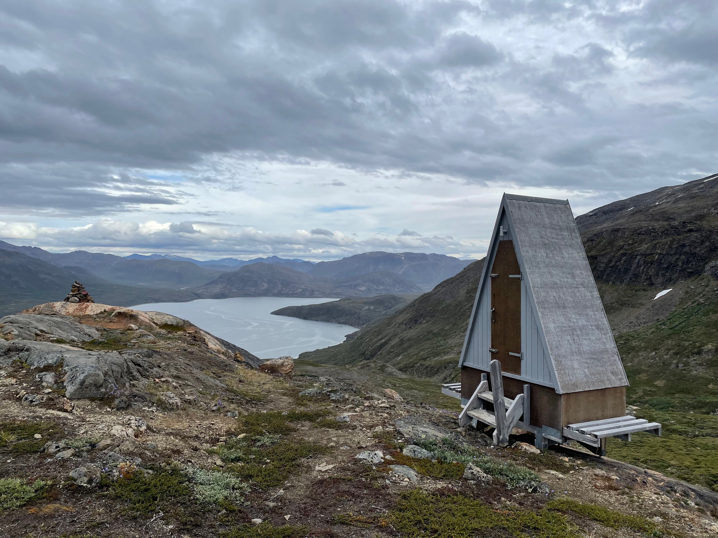
THE HUT AT KANGERLUARSUK TULLEQ
I reached the hut shortly after sunset but noticed that no tents were set up nearby so I wondered if maybe I lucked out and the hut was empty. Switching my headlamp to red so as not to shine a bright light in case folks were sleeping, I slowly opened the top half of the door. There was room inside but everyone was asleep so I chose to set up my tent for my last night on the trail. I found a comfy spot a fair distance from the hut so that I could sleep in before heading in to Sisimiut. I’d been on the trail for 13 hours and hoped to avoid eastbound early risers eager to start their second day of trekking.
14 AUG 2022: Day 8
THE FAMOUS MOUNTAIN TOILET
Slept in as planned and was surprised to find a couple still going in and out of the hut as I packed up. They kept the door open while going about their business which sort of ruins it for the folks that come after them – allowing mosquitos to enter at will – so please close the door behind you.
I ran into another Eastbounder as I started the trek into town but for the most part I had the trail to myself. As I neared the famous mountain toilet – not sure what else to call it? – I heard the voices of both humans and dogs and assumed there were some hunters nearby. As my path merged with another I was surprised to see a team of sledge dogs but no sledge. In command and on foot was 16 year old Malik Sivertsen from Sisimiut. Malik and his father Tore – who observed from a nearby hillside – were practicing with the dogs and moving up to having them pull an ATV along the trail as they prepared for the winter season. We chatted for a while but as the rain started to fall it was time to move on.
MALIK GETTING HIS DOGS READY FOR WINTER

ALMOST TO SISIMIUT
Rain fell steadily for the rest of the day as I walked the familiar route into Sisimiut. On my last few trips on the trail. – guiding folks from Eqalugaarniarfik to Sisimiut – I would start motivating them with talk of visiting the bakery in Sisimiut and enjoying freshly baked pastries as we descended into the valley alongside Mt. Nasaasaaq. With only myself to motivate I started dreaming of a beer and burger at Hotel Sisimiut.
As I approached the ski lifts near town the trail started blending in with – and being taken over by – the new ATV road which made me even more grateful for the opportunity to scout out the new and untrampled Southern Route. I walked alongside “Dog Town” and watched as the sledge dogs lazily noted my passing with barely a sound, saving their voices for when their owners came with food.

SISIMIUT WITH NASAASAAQ IN THE BACKGROUND
I reached the tarmac road and walked towards the center of town. After 8 days or more on the trail I think most hikers walk into Sisimiut half expecting a welcome ceremony, proud of what they have accomplished and wanting to share tales of their adventures with world. The truth is that you’re just another face on the tapestry that makes up what I consider to be Greenland’s most authentic city – each with a story to tell – so you’ll have to settle for a warm bed and a hot shower.
Sisimiut is not a tourist town and in Sisimiut you get to see what life is like for the average Greenlander, whether that’s heading out to work on a fishing boat, teaching the next generation, or getting dressed up in the national costume to honor the memory of a loved one from the last generation. In Sisimiut there aren’t restaurants or bars that target crowds of European and American visitors, there are only places where everyone comes together and both culture and good times are shared by all.

HOTEL SISIMIUT
I arrived at Hotel Sisimiut and dropped my pack in my room before quickly heading down to the restaurant to place my order. I wound up ordering a chicken burger, fries, and a salad – all. Of which were delicious – and washed it all down with a couple of Tuborg Classics. Hotel Sisimiut (http://www.hotelsisimiut.com) offers a hiker package that includes 3 nights for the price of 2 and, perhaps most important after 8 or more days on the trail, a free load of laundry! The hotel can fill up so I recommend reserving in advance so you can enjoy time in the hot tub reflecting on the adventure of a lifetime while your laundry is being folded for you.

GREENLAND FLAG ON THE ROAD TO SISIMIUT AIRPORT
If you are an experienced backpacker, and are comfortable navigating off trail, the Southern Route is definitely your best option. Keep in mind that around 95% of the time there is no trail but that also mean less people and no ATV road. There’s talk of the Southern Route becoming the main route from Kangerlussuaq to Sisimiut, with the trail rerouted to the southern side of Nasaasaaq in order to get away from the ATV road completely, but that’s probably a few years away. For now those choosing this more challenging route will be rewarded with solitude, unspoiled wilderness, and adventure. I hope you’ll follow in my footsteps but please tread lightly and pack out your trash.
NOTES
SHIPPING YOUR LUGGAGE TO SISIMIUT

AIR GREENLAND CARGO CENTER AT KANGERLUSSUAQ AIRPORT
Exit the terminal and turn left to follow the path towards Polar Lodge. Veer slightly left towards the fire station and then straight back towards the blue building with the Air Greenland sign. They are technically closed on Sundays and the best time to reach them on other days is between 9-11 am. I shipped 2 bags weighing a total of 32kg and was charged 931.40 DKK ($126.37). The bags arrived the next day and when I arrived in Sisimiut after my 8 day trek I simply took a taxi to the airport during regular business hours to retrieve them. You can check out shipping rates by clicking on the link below

KANGERLUSSUAQ AIRPORT
GETTING TO THE EASTERN TRAILHEAD
1. Arctic Circle Tours – Call/email to schedule (minik@1234.gl/+299-560-0102)
2. Albatros Arctic Circle – Kangerlussuaq Sightseeing Tour: 1pm departure/395 DKK (about $55) (https://albatros-arctic-circle.com/sightseeing-kangerlussuaq)
ESSENTIAL SKILLS
1. Pack it in/Pack it out: There are blue trash dumpsters at some, but not all of the huts. Don’t count on them and plan to haul your trash with you for the entire route. If you see a 50 gallon drum near a hut that does not mean you can leave your trash there. These are open to the wind and the wind will quickly litter the landscape with your food wrappers and bath wipes. Don’t ruin it for others!
2. Know how to dig a cathole: If there’s no toilet/privy nearby that’s absolutely no excuse to just leave your waste and toilet paper out in the open. If you’re going to tackle this trail you must know how to properly dispose of your poop. (https://lnt.org/when-nature-calls-how-to-dig-a-cathole/)
3. Canoe J-Stroke to paddle in a straight line (https://www.google.com/search?q=canoe+j+stroke&oq=canoe+j+s&aqs=chrome.0.0i512j69i57j0i512j0i22i30l5j0i390l2.3536j0j7&sourceid=chrome&ie=UTF-8)

HOW TO DRY YOUR SOCKS
4. How to dry your wet socks: Boil a liter of water and pour into a reusable water bottle such as Nalgene®. Wrap your wet socks around the bottle and secure in place with some cordage or a rubber band.
TIPS

TORTILLA PIZZA
Tortilla Pizza:
Ingredients
Small taco sized tortillas
Pizza sauce: Pour into a resealable plastic bag to save weight and then place in a second resealable bag in case of a leak.
Shredded mozzarella cheese: Purchase as close to your departure time as possible and you can expect the cheese to stay fresh for at least 4 days.
Preparation
Place tortilla in the bottom of your cookpot or a small frying pan (Canoe center has a few).
Spoon pizza sauce onto tortilla and spread evenly but leave some distance to the edge.
Cover generously with cheese
Cooking
This is the tricky part. If you have a liquid fuel stove you can likely simmer at low heat. If you have a canister fuel stove it takes some practice.
Cover the cookpot to help melt the cheese
If using a liquid fuel stove, cook at low to medium heat and use your spork to shift the tortilla around to prevent burning. If using a canister fuel stove hold the cookpot at least 2 fists above the stove itself and only cook for about 15-30 seconds to prevent burning. No stove? Even cold it’s still delicious!
Canoes: If you’re set on paddling across the lake I recommend rising early and setting off before you eat breakfast. If you are paddling from Kattifik to Canoe Center there is a beach along the north shore about 45-60 minutes into the trip. If you are paddling from Canoe Center to Kattifik there is a beach on the south shore, just around the bend, about 15-30 minutes into the trip. I recommend that you get started as early as possible and then pull in to either beach for breakfast.
Bring earplugs if you plan to sleep in a hut. There’s always someone snoring and if you don’t believe this than it’s you.
Bring a sleep mask or clean bandana if you want to save weight. The days are long during the arctic summer and a sleep mask will help you get the rest you need to tack the trail.
Plan for a slower pace: Expect to be bushwhacking with a footpath available about 5% of the time. As you cross through terrain such as scrub willow thickets you need to move slowly so as to look for postholes that can lead to a broken leg. You also need to plan your route based on the terrain in front of you so in general I would plan for 1 mile/1.6 km per hour whereas on the Northern Route you can generally maintain twice that speed or more.
Sleeping bag: Bring a sleeping rated for 10 deg F (around 6 deg C) lower than the lowest temperature you expect to encounter on your journey and pair it with a sleeping pad that has a thermal resistance value (R value) of at least 2.0. Sleeping bag temperature ratings are based on the assumption that you are using a pad to insulated you from the ground and prevent heat loss through conduction.
Bring Deet: The mosquitos in Greenland can be vicious – especially in June/July – so bring an insect repellent containing at least 30% Deet but avoid 100% Deet since it’s a very effective but nasty chemical that will melt synthetic clothing an gear in pure form.
NOTES
No need to filter/treat your water as long as you draw water from moving sources (rivers and streams) or large lakes. Boil water take from standing sources (ponds and bogs)
My pack weighed just over 50 lbs (around 23 kg) when I set off from Kangerlussuaq
GPS route info (.gpx file): https://arcticcircletrail.gl/hiking/before-you-start/act-navigation-maps-gps/
I uploaded the .gpx file to the ‘GPS Tracks’ app which worked well though this is the first smart phone GPS app I’ve used so I’m not endorsing this app or any others.
Visit Greenland’s Arctic Circle Trail page: https://visitgreenland.com/things-to-do/arctic-circle-trail/
Destination Arctic Circle’s trail page: https://arcticcircletrail.gl